
Animating the Falls Lake drawdown with r.anim.morph
grass
remote-sensing
sentinel-2
stac
animation
tutorial
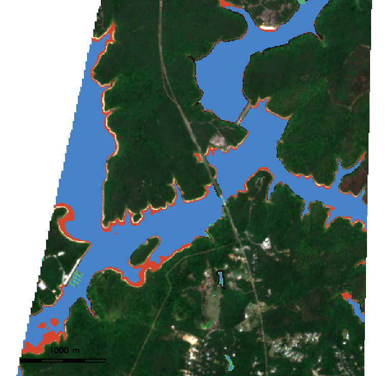
Introducing r.anim.morph: pull two Sentinel-2 scenes a year apart with t.stac and morph them into a spatially aware before-and-after animation of Falls Lake, North Carolina…
Jul 17, 2026