import sys
v = sys.version_info
print(f"We are using Python {v.major}.{v.minor}.{v.micro}")
We are using Python 3.10.12Corey T. White
Vaclav Petras
September 19, 2024
This notebook is a quick introduction to GRASS and Jupyter Notebooks.
By default all cells are running Python:
We are using Python 3.10.12If you are running this notebook in Colab, you will need to install GRASS GIS and its Python API. You can do this by running the following cell:
%%bash

apt-get install grass grass-dev grass-doc
# leave the directory with source code
cd ~

# download sample data
mkdir -p grassdata
mkdir -p output
curl -SL https://grass.osgeo.org/sampledata/north_carolina/nc_basic_spm_grass7.zip > nc_basic_spm_grass7.zip
unzip -qq nc_basic_spm_grass7.zip
mv nc_basic_spm_grass7 grassdata
rm nc_basic_spm_grass7.zip

pip install figletBut you can also run shell commands by prefixing them with ! or use %%bash to run the whole cell as a shell script.
  ____ ____      _    ____ ____     ____ ___ ____    _  ___  _
 / ___|  _ \    / \  / ___/ ___|   / ___|_ _/ ___|  / |/ _ \/ |
| |  _| |_) |  / _ \ \___ \___ \  | |  _ | |\___ \  | | | | | |
| |_| |  _ <  / ___ \ ___) |__) | | |_| || | ___) | | | |_| | |
 \____|_| \_\/_/   \_\____/____/   \____|___|____/  |_|\___/|_|
GRASS GIS 8.3.1
Geographic Resources Analysis Support System (GRASS) is Copyright,
1999-2023 by the GRASS Development Team, and licensed under terms of the
GNU General Public License (GPL) version >=2.

This GRASS GIS 8.3.1 release is coordinated and produced by
the GRASS Development Team with contributions from all over the world.

This program is distributed in the hope that it will be useful, but
WITHOUT ANY WARRANTY; without even the implied warranty of
MERCHANTABILITY or FITNESS FOR A PARTICULAR PURPOSE.  See the GNU
General Public License for more details.# !ogrinfo "/vsizip//vsicurl/https://www.stlouis-mo.gov/data/upload/data-files/stl_boundary.zip" -al
# !ogrinfo /vsizip//vsicurl/https://www.stlouis-mo.gov/data/upload/data-files/streets.zip -al
# !ogrinfo /vsizip/vsicurl/https://static.stlouis-mo.gov/open-data/planning/neighborhoods/neighborhoods.zip/Neighborhoods -al
!ogrinfo "https://services1.arcgis.com/fBc8EJBxQRMcHlei/arcgis/rest/services/NPS_Land_Resources_Division_Boundary_and_Tract_Data_Service/FeatureServer/2/query?outFields=*&where=1%3D1&f=geojson" -alLet’s import some vector data from the city of St. Louis’ open data portal.
https://www.stlouis-mo.gov/data/datasets/index.cfm
streets_url="/vsizip//vsicurl/https://www.stlouis-mo.gov/data/upload/data-files/streets.zip"
# streets_url="http://maps.stlouisco.com/arcgis/rest/services/OpenData/OpenData/FeatureServer/1/query?outFields=*&where=1%3D1&f=geojson"
gs.run_command("v.import",
   input=streets_url,
   output="stl_streets",
   snap=0.0001,
   layer="tgr_str_cl"
)neigh_url="https://services1.arcgis.com/fBc8EJBxQRMcHlei/arcgis/rest/services/NPS_Land_Resources_Division_Boundary_and_Tract_Data_Service/FeatureServer/2/query?outFields=*&where=1%3D1&f=geojson"
gs.run_command("v.import",
input=neigh_url,
output="stl_park",
snap=0.001,
layer="OGRGeoJSON",
extent="region"
)projection: 99 (NAD83(HARN) / Missouri West)
zone: 0
datum: nad83harn
ellipsoid: grs80
north: 298260
south: 271020
west: 1214160
east: 1226670
nsres: 30
ewres: 30
rows: 908
cols: 417
cells: 378636https://stacindex.org/catalogs
---------------------------------------------------------------------------
Catalog: Earth Search by Element 84
---------------------------------------------------------------------------
Client Id: earth-search-aws
Client Description: A STAC API of public datasets on AWS
Client STAC Extensions: []
Client catalog_type: ABSOLUTE_PUBLISHED
---------------------------------------------------------------------------
Collections: 9
---------------------------------------------------------------------------
Collection Id | Collection Title
---------------------------------------------------------------------------
sentinel-2-pre-c1-l2a: Sentinel-2 Pre-Collection 1 Level-2A
cop-dem-glo-30: Copernicus DEM GLO-30
naip: NAIP: National Agriculture Imagery Program
cop-dem-glo-90: Copernicus DEM GLO-90
landsat-c2-l2: Landsat Collection 2 Level-2
sentinel-2-l2a: Sentinel-2 Level-2A
sentinel-2-l1c: Sentinel-2 Level-1C
sentinel-2-c1-l2a: Sentinel-2 Collection 1 Level-2A
sentinel-1-grd: Sentinel-1 Level-1C Ground Range Detected (GRD)
---------------------------------------------------------------------------Collection ID: cop-dem-glo-30
STAC Version: 1.0.0
Description: The Copernicus DEM is a Digital Surface Model (DSM) which represents the surface of the Earth including buildings, infrastructure and vegetation. GLO-30 Public provides limited worldwide coverage at 30 meters because a small subset of tiles covering specific countries are not yet released to the public by the Copernicus Programme.
Extent: {'spatial': {'bbox': [[-180, -90, 180, 90]]}, 'temporal': {'interval': [['2021-04-22T00:00:00Z', '2021-04-22T00:00:00Z']]}}
License: proprietary
Keywords: ['Copernicus', 'DEM', 'DSM', 'Elevation']
---------------------------------------------------------------------------
Summary:
gsd: [30]
platform: ['tandem-x']
proj:epsg: [4326]
storage:platform: ['AWS']
storage:region: ['eu-central-1']
storage:requester_pays: [False]
---------------------------------------------------------------------------
Item Assets Keys: ['data']
---------------------------------------------------------------------------
Asset: Data
Key: data
Roles: ['data']
Type: image/tiff; application=geotiff; profile=cloud-optimized
Description: None
Raster Bands:
Band: {'sampling': 'point', 'data_type': 'float32', 'spatial_resolution': 30, 'unit': 'meter'}
---------------------------------------------------------------------------
The t.stac.item module will download the Copernicus DEM GLO-30 data from the STAC catalog.
Downloading Asset: {'href': 's3://copernicus-dem-30m/Copernicus_DSM_COG_10_N38_00_W091_00_DEM/Copernicus_DSM_COG_10_N38_00_W091_00_DEM.tif', 'type': 'image/tiff; application=geotiff; profile=cloud-optimized', 'title': 'Data', 'raster:bands': [{'sampling': 'point', 'data_type': 'float32', 'spatial_resolution': 30, 'unit': 'meter'}], 'roles': ['data'], 'collection_id': 'cop-dem-glo-30', 'item_id': 'Copernicus_DSM_COG_10_N38_00_W091_00_DEM', 'file_name': 'cop-dem-glo-30.Copernicus_DSM_COG_10_N38_00_W091_00_DEM.data', 'datetime': '2021-04-22T00:00:00Z'}
Import Url: /vsis3/copernicus-dem-30m/Copernicus_DSM_COG_10_N38_00_W091_00_DEM/Copernicus_DSM_COG_10_N38_00_W091_00_DEM.tif
Importing: cop-dem-glo-30.Copernicus_DSM_COG_10_N38_00_W091_00_DEM.data
Let’s rename our elevation raster to cop-dem-glo-30.
gs.run_command("g.region", raster="cop-dem-glo-30", res=30, flags="ap")
gs.run_command("r.colors", map="cop-dem-glo-30", color="elevation")
gs.run_command("r.relief", input="cop-dem-glo-30", output="relief", overwrite=True)

map = gj.Map(width=300)
map.d_shade(shade="relief", color="cop-dem-glo-30")
map.d_vect(map="stl_boundary", color="red", fill_color="none")
map.d_vect(map="stl_park", color="purple", fill_color="none")
# map.d_vect(map="stl_streets", color="grey", fill_color="none", width=0.25)
map.d_legend(raster="cop-dem-glo-30", at="5,50,2,5", flags="b")
map.show()
projection: 99 (NAD83(HARN) / Missouri West)
zone: 0
datum: nad83harn
ellipsoid: grs80
north: 298260
south: 271020
west: 1214160
east: 1226670
nsres: 30
ewres: 30
rows: 908
cols: 417
cells: 378636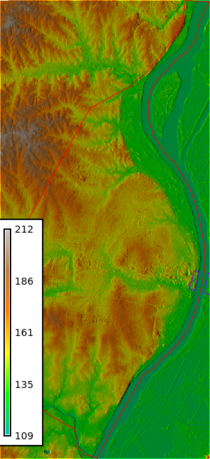
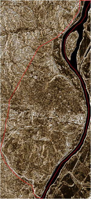
Let’s calculate the slope of the elevation raster.
gs.run_command("r.mask", vector="stl_boundary")
gs.run_command("v.to.rast", input="stl_streets", output="stl_streets", use="value", type="line", overwrite=True)
gs.run_command("r.grow.distance", input="stl_streets", distance="dist_to_road")
gs.run_command("r.colors", map="dist_to_road", color="plasma", flags="e")
map1 = gj.Map(width=300)
map1.d_shade(shade="relief", color="dist_to_road")
map1.d_vect(map="stl_boundary", color="red", fill_color="none")
map1.d_legend(raster="dist_to_road", at="95,65,5,15", range="0,100", flags="ds")
map1.show()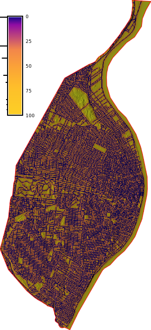
gs.run_command("r.neighbors", flags="", input="stl_streets", output="road_dens", size=37, method="count", memory=30000, nprocs=24)
gs.run_command("r.colors", map="road_dens", color="plasma", flags="")
map2 = gj.Map(width=300)
map2.d_shade(shade="relief", color="road_dens")
map2.d_vect(map="stl_boundary", color="red", fill_color="none")
map2.d_legend(raster="road_dens", at="95,65,5,15", flags="s")
map2.d_barscale(at="55,5,5,5", flags="n")
map2.show()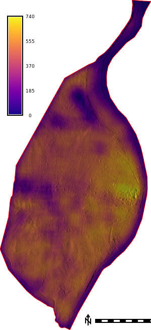
gs.run_command("r.geomorphon", elevation="cop-dem-glo-30", search=15, flat=0.1, forms="geomorphon", overwrite=True)
map = gj.Map(width=300)
map.d_shade(shade="relief", color="geomorphon")
map.d_vect(map="stl_boundary", color="red", fill_color="none")
map.d_legend(raster="geomorphon", at="95,65,2,5", flags="")
map.show()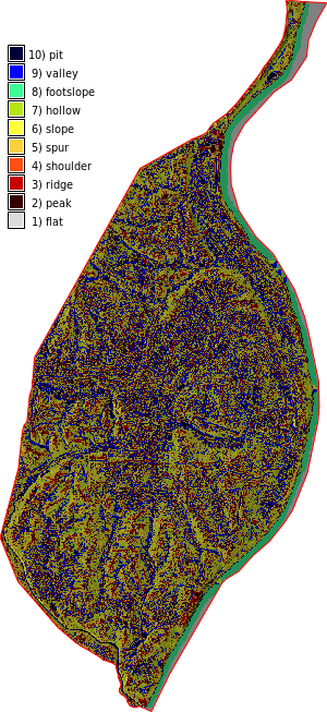
Let’s run some bash commands to calculate flow accumulation.
We can start by downloading the new r.flowaccumulation module from the GRASS Addons repository.
%%bash

g.extension extension=r.flowaccumulation

# calculate positive flow accumulation and drainage directions using r.watershed
# for comparison, use -s (SFD)
r.watershed -sa elevation=cop-dem-glo-30 accumulation=flow_accum drainage=drain_directions

# calculate flow accumulation using r.flowaccumulation
r.flowaccumulation input=drain_directions output=flow_accum_new

# copy color table
r.colors map=flow_accum_new raster=flow_accum
Fetching <r.flowaccumulation> from <https://github.com/OSGeo/grass-addons/>
(be patient)...
Already on 'grass8'Your branch is up to date with 'origin/grass8'.Compiling...
Installing...
Updating extensions metadata file...
Updating extension modules metadata file...
Installation of <r.flowaccumulation> successfully finished
SECTION 1a (of 4): Initiating Memory.
SECTION 1b (of 4): Determining Offmap Flow.
0 4 8 12 16 20 24 28 32 36 40 44 48 52 56 60 64 68 72 76 80 84 88 92 96 100
SECTION 2: A* Search.
0 2 4 6 8 10 12 14 16 18 20 22 24 26 28 30 32 34 36 38 40 42 44 46 48 50 52 54 56 58 60 62 64 66 68 70 72 74 76 78 80 82 84 86 88 90 92 94 96 98 100
SECTION 3: Accumulating Surface Flow with SFD.
1 3 5 7 9 11 13 15 17 19 21 23 25 27 29 31 33 35 37 39 41 43 45 47 49 51 53 55 57 59 61 63 65 67 69 71 73 75 77 79 81 83 85 87 89 91 93 95 97 99 100
SECTION 4: Closing Maps.
Writing out only positive flow accumulation values.
Cells with a likely underestimate for flow accumulation can no longer be
identified.
Using 1 thread for serial computation
Reading flow direction raster <drain_directions>...
Flow direction format assumed to be degrees CCW from East divided by 45
0 2 4 6 8 10 12 14 16 18 20 22 24 26 28 30 32 34 36 38 40 42 44 46 48 50 52 54 56 58 60 62 64 66 68 70 72 74 76 78 80 82 84 86 88 90 92 94 96 98 100
Input time for flow direction: 0.008398 seconds
Accumulating flows...
Compute time for flow accumulation: 0.006112 seconds
Writing flow accumulation raster <flow_accum_new>...
0 2 4 6 8 10 12 14 16 18 20 22 24 26 28 30 32 34 36 38 40 42 44 46 48 50 52 54 56 58 60 62 64 66 68 70 72 74 76 78 80 82 84 86 88 90 92 94 96 98 100
Output time for flow accumulation: 0.011455 seconds
Total elapsed time: 0.025998 seconds
Color table for raster map <flow_accum_new> set to 'flow_accum'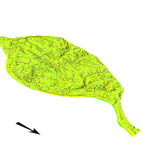
Let’s zoom in on the Arch Park area.
projection: 99 (NAD83(HARN) / Missouri West)
zone:       0
datum:      nad83harn
ellipsoid:  grs80
north:      282180
south:      280770
west:       1225440
east:       1226970
nsres:      30
ewres:      30
rows:       47
cols:       51
cells: 2397gs.run_command("r.mask", vector="stl_boundary")
map = gj.Map(width=500, use_region=True)
map.d_shade(shade="relief", color="flow_accum_new")
map.d_vect(map="stl_boundary", color="red", fill_color="none")
map.d_vect(map="stl_park", color="red", fill_color="none", width=3)
map.d_legend(raster="cop-dem-glo-30", at="5,50,80,75", flags="b")
map.show()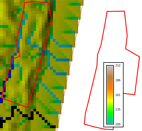
gs.run_command("r.mask", vector="stl_boundary")
gs.run_command("g.region", raster="flow_accum_new", res=30, flags="ap")
map = gj.InteractiveMap(width=500, map_backend="folium", use_region=True)
map.add_raster("flow_accum_new", opacity=0.5)
map.add_raster("relief", opacity=0.75)
map.add_vector("stl_boundary", fill_color="none", line_color="red")
map.add_vector("stl_park", fill_color="none", line_color="green")
map.show()
projection: 99 (NAD83(HARN) / Missouri West)
zone: 0
datum: nad83harn
ellipsoid: grs80
north: 298260
south: 271020
west: 1214160
east: 1226670
nsres: 30
ewres: 30
rows: 908
cols: 417
cells: 378636cop-dem-glo-30 raster map.Let’s move to Part 2: Actinia 101